
![]()
Northern California Sections
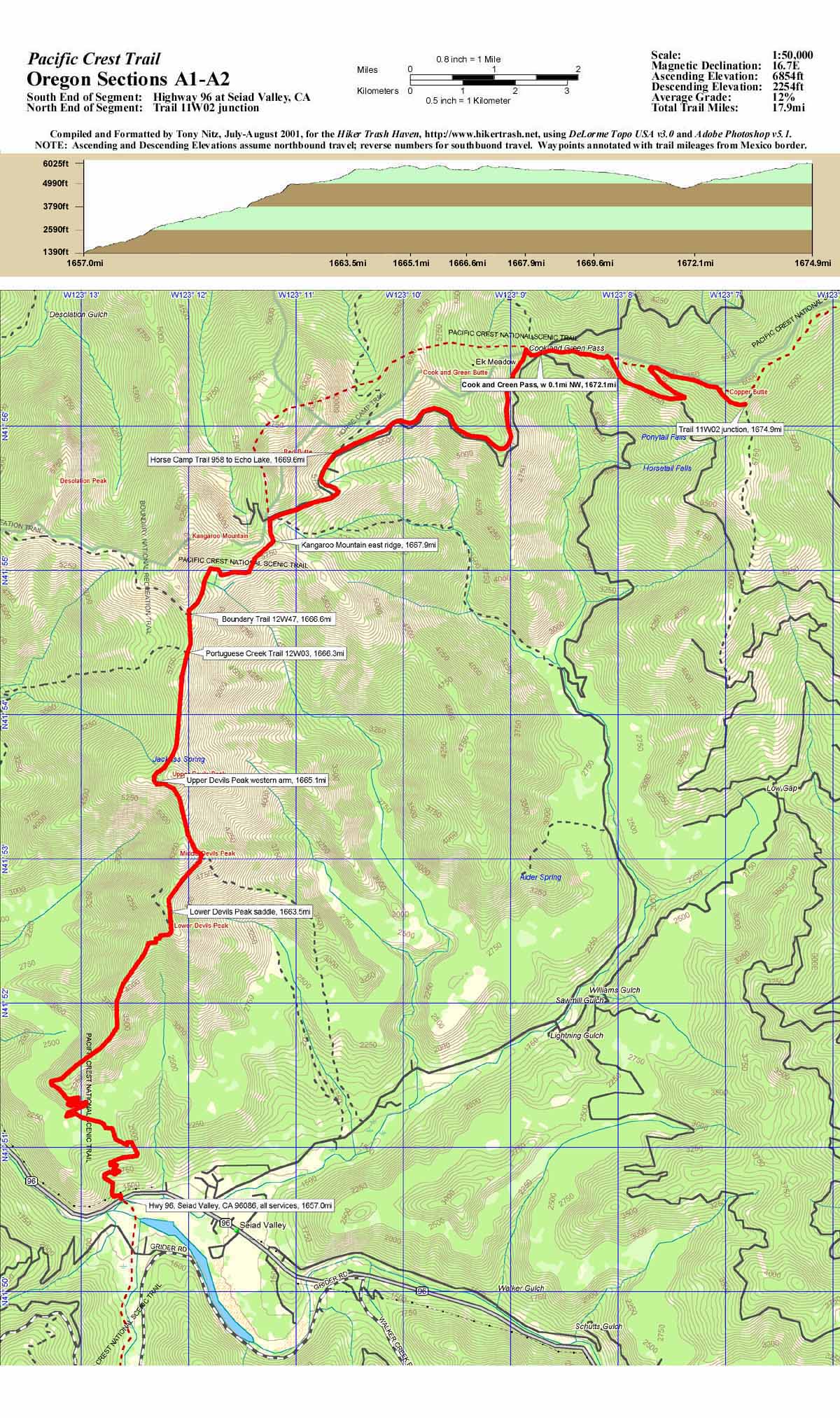
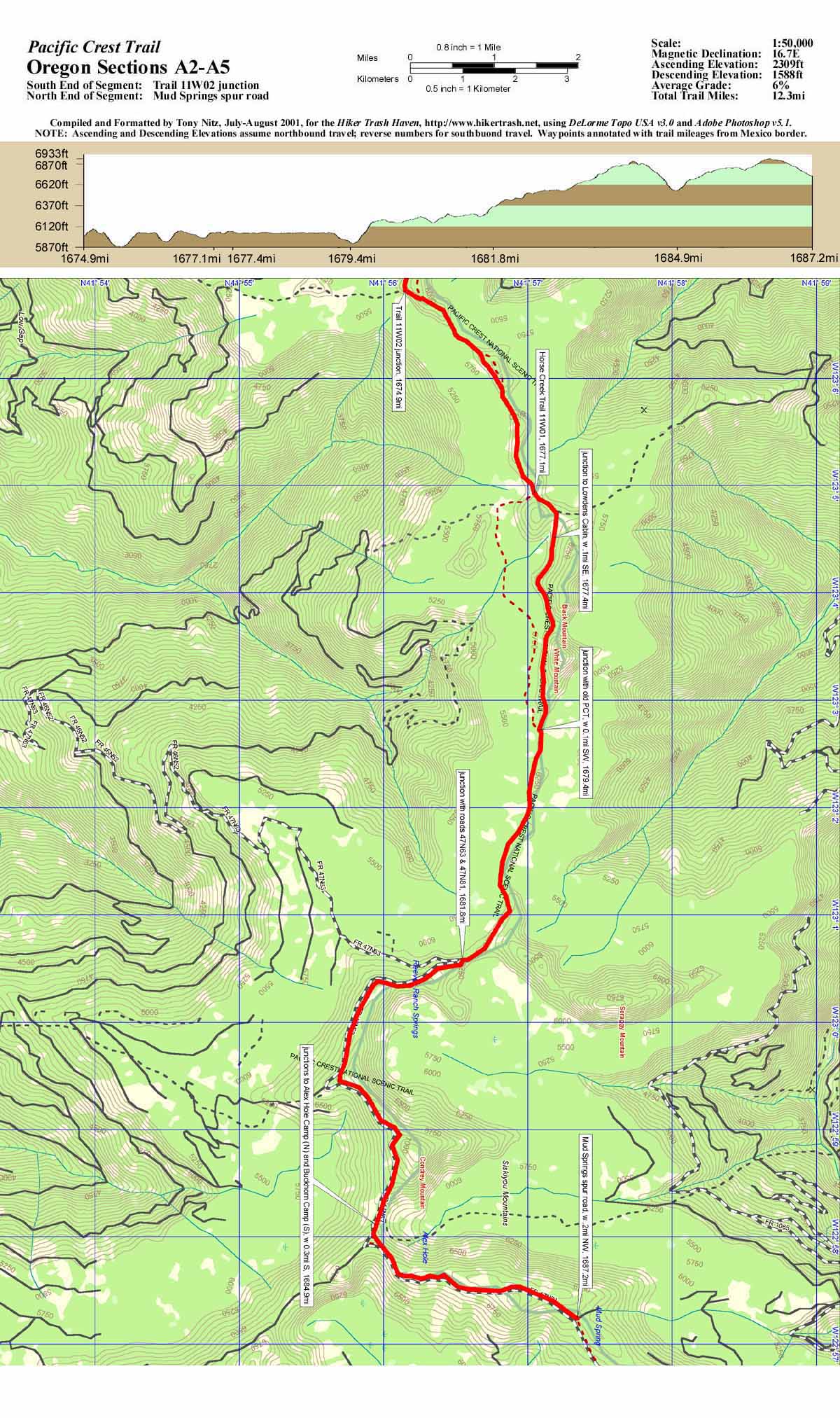
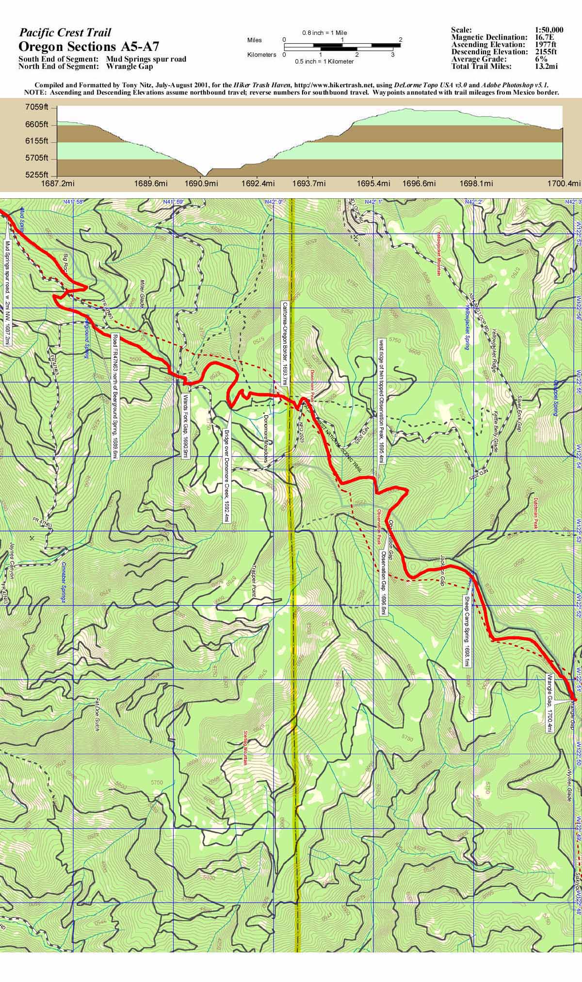
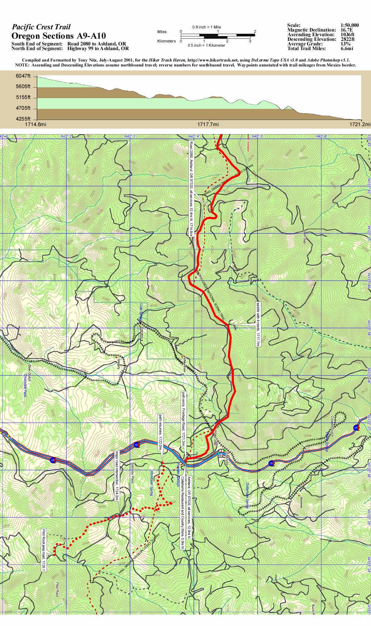
The northern California maps have not been completed yet. However, California Section R is the exact same map set as Oregon Section A. So, the Section R maps I've provided links to here, you will see labeled as Oregon Section A. Don't be alarmed! As I said, they are the same. Feel free to view or download any or all that you may be able to use yourself. The maps are produced in 1:50,000 scale, and each map will cover a trail segment of about fifteen miles. Each map image is approximately 300KBytes in size, and will print at approximately 8" x 13.5", at 150dpi. You should be able to print these maps on any average quality color inkjet printer using 8.5" x 14" paper.
Sections R1-R2, Seiad Valley to Trail 11W02, 17.9
miles
Sections R2-R5, Trail 11W02 to Mud Springs spur
road, 12.3 miles
Sections R5-R7, Mud Springs spur road to Wrangle
Gap, 13.2 miles
Sections R7-R9, Wrangle Gap to Road 2080 to
Ashland, 14.2 miles
Sections R9-R10, Road 2080 to Ashland, to Highway
99 to Ashland, 6.6 miles
![]()
![]()
![]()
|
|
Hiker
Trash Haven copyright © 1997-2004 by Nitz Technologies, LLC. All rights reserved. Advertising and privacy policies. Revised: Sunday, 13 June 2004 14:10 -0700 Pages published on this site were tested using Netscape v6.2 and Microsoft Internet Explorer v6. |