
![]()
![]()
![]()
![]()
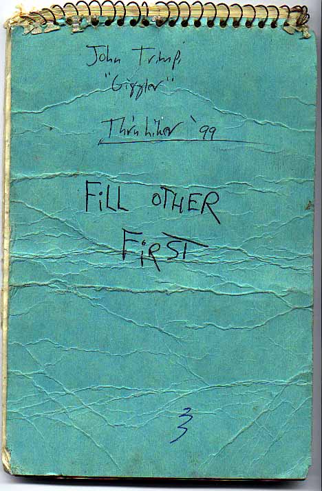
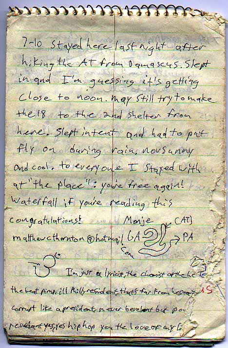
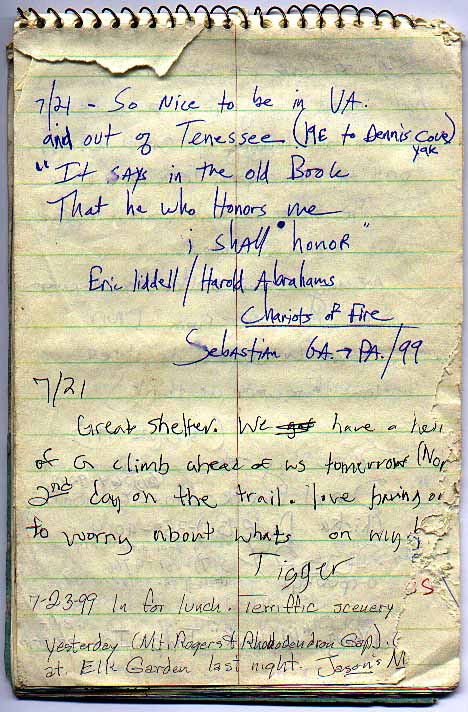
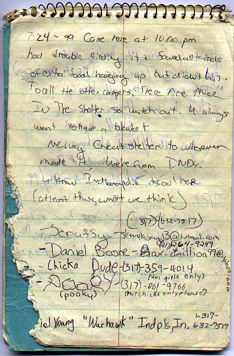
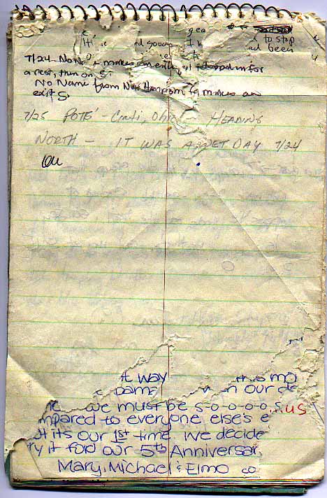
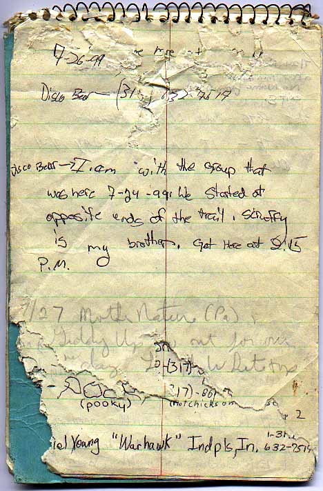
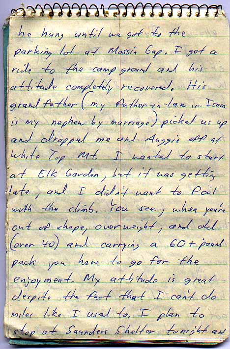
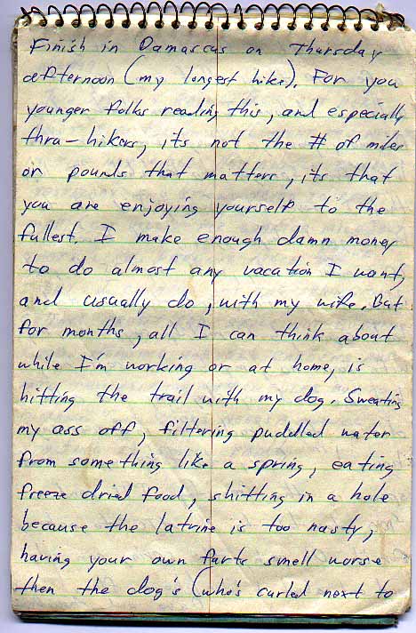
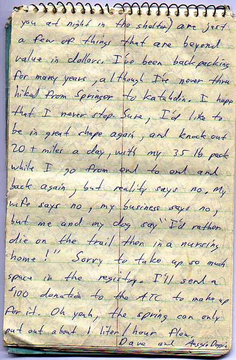
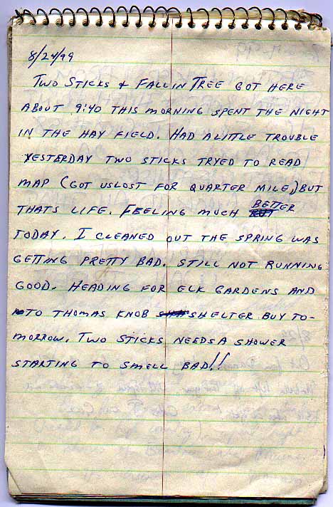
This shelter register was left at Lost Mountain Shelter, 1.2 miles north of Virginia Route 859, at Whitetop Laurel Creek, and 1.1 miles south of U.S. Highway 58, the road access to Summit Cut, Virginia. The register has sustained much damage from rough handling and hungry mice. It was placed in the shelter by John "Giggler" Trimpi, a 1999 northbound thru-hiker. However, there was no address to indicate whether or how to send the completed register back to Giggler. Fortunately, two of Giggler's hiking partners, Drum Stick and Wak-A-Pak, saw the register after it was posted here and provided a return address. Hiker and register have now been reunited! Thanks, Giggler, for allowing it to continue to be displayed here for everyone else's enjoyment. The first surviving entry was made on 9 July 1999, and the last entry was on 15 September 1999. Another register had already been in place in the shelter for about six weeks, so Prehistoric Tony packed this one out after his stay there the night of 26 November 1999. The register's 32 pages have been scanned, and are displayed here in order and unedited. To aid in finding a page of interest, the caption for each page indicates the date of the first entry on that page. To read a page of the register, just click on the thumbnail for a full sized view.
![]()
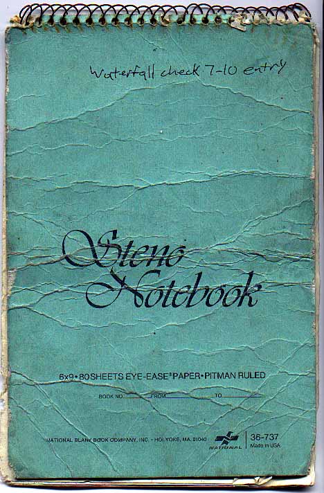 Cover |
 Credits |
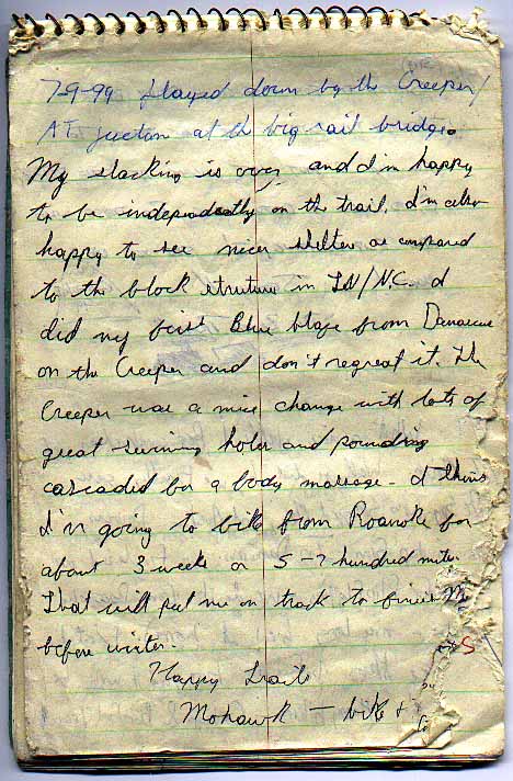 9 Jul 99 |
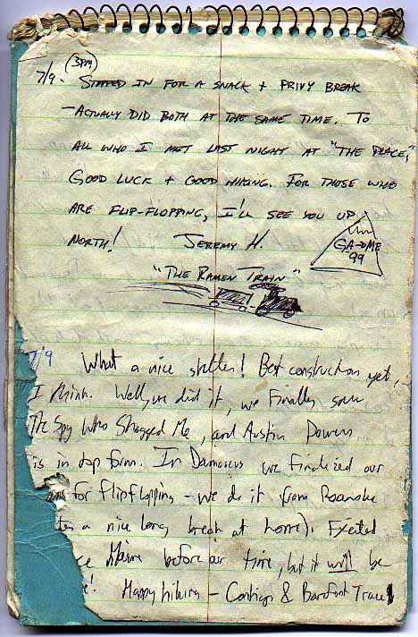 9 Jul 99 |
 10 Jul 99 |
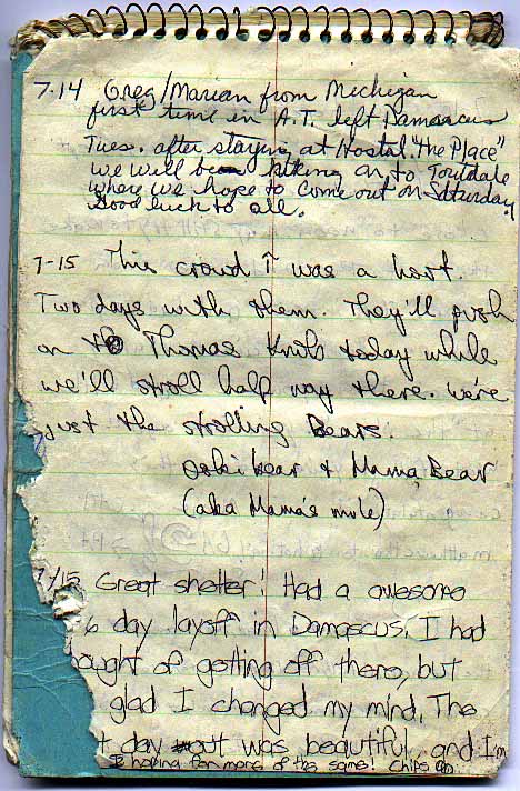 14 Jul 99 |
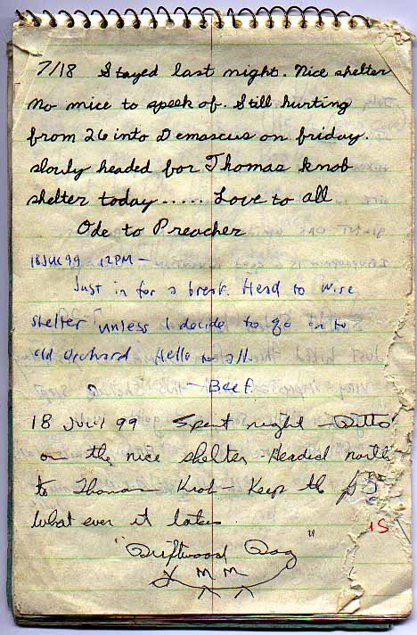 18 Jul 99 |
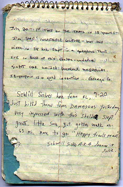 20 Jul 99 |
 21 Jul 99 |
 24 Jul 99 |
 24 Jul 99 |
 26 Jul 99 |
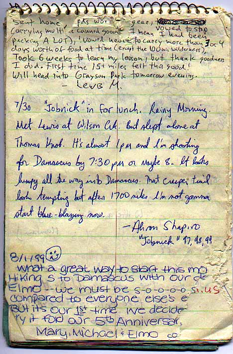 30 Jul 99 |
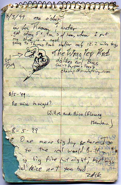 3 Aug 99 |
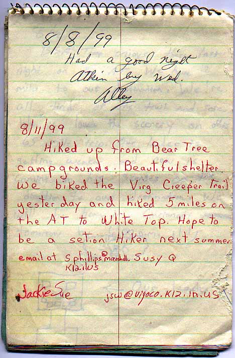 8 Aug 99 |
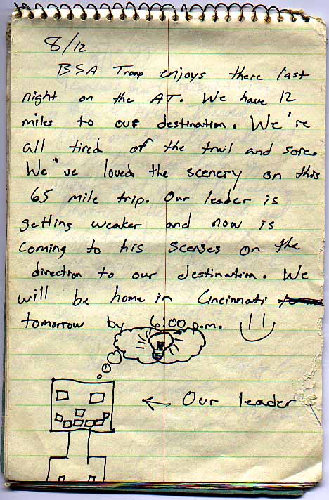 12 Aug 99 |
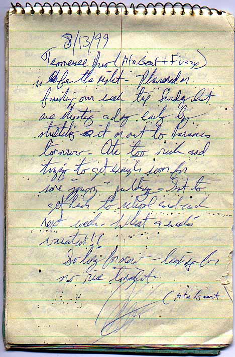 13 Aug 99 |
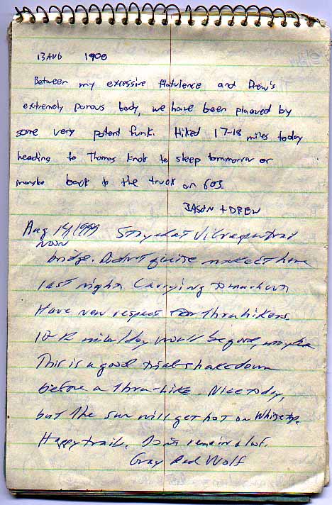 13 Aug 99 |
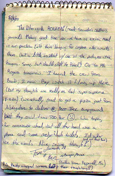 16 Aug 99 |
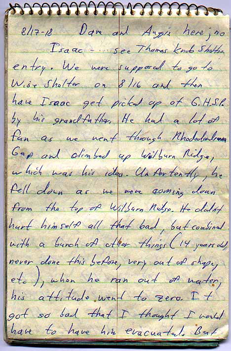 17 Aug 99 |
 17 Aug 99 |
 17 Aug 99 |
 17 Aug 99 |
 24 Aug 99 |
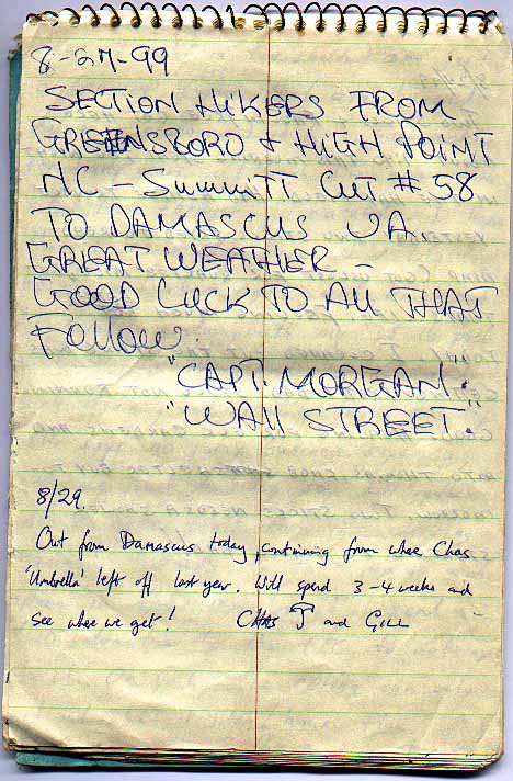 27 Aug 99 |
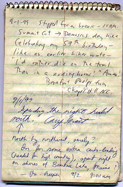 1 Sep 99 |
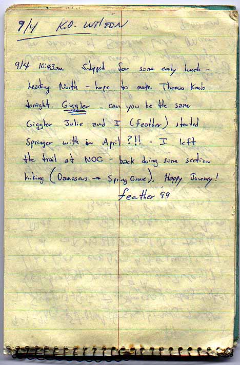 4 Sep 99 |
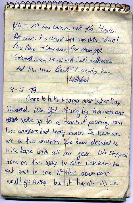 4 Sep 99 |
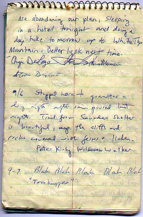 6 Sep 99 |
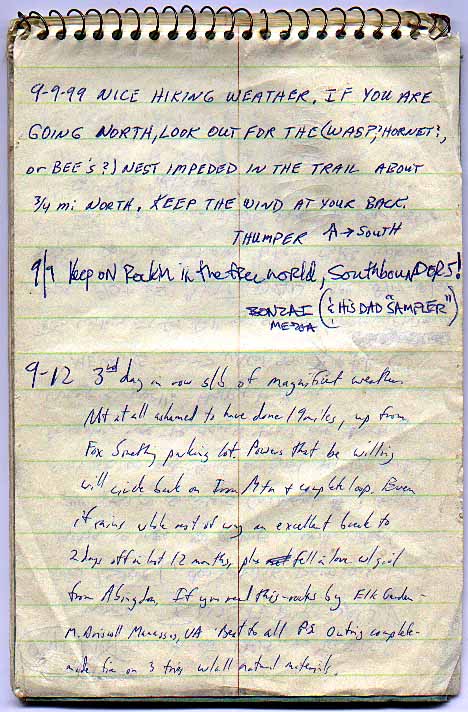 9 Sep 99 |
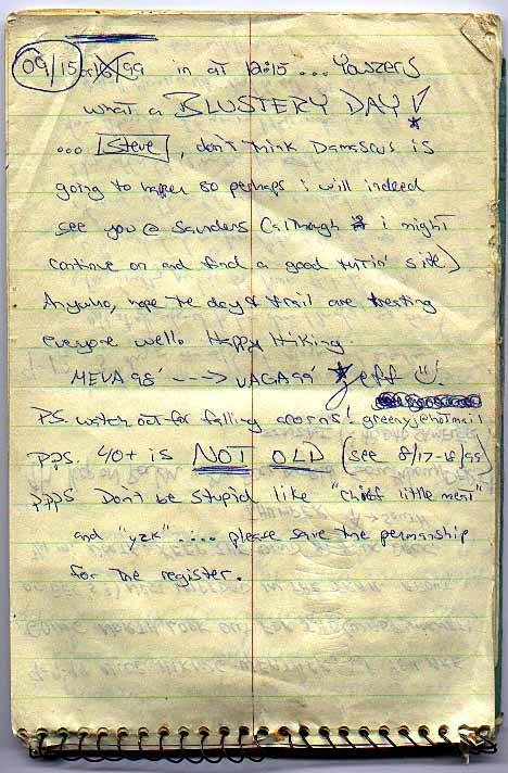 15 Sep 99 |
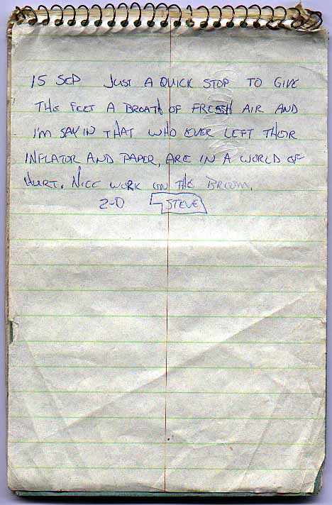 15 Sep 99 |
![]()
![]()
![]()
![]()
|
|
Hiker
Trash Haven copyright © 1997-2004 by Nitz Technologies, LLC. All rights reserved. Advertising and privacy policies. Revised: Sunday, 13 June 2004 14:10 -0700 Pages published on this site were tested using Netscape v6.2 and Microsoft Internet Explorer v6. |